We’ve been starting to show you images of what the icy surface of the Ross Sea looks like from below, but some of the most fascinating things we’ve seen are actually on the seafloor. Not everyone is aware of the fact that there’s actually a rich community of organisms living in these waters, and rightfully so! It’s pretty impressive that their existence is possible in a world that lacks any light and food from algae for many months of the year.
The top of “Dayton’s Wall”, the animal-covered feature for which this dive site is named. Our descent line in the background.
The last two days I have taken a break from sample collection tasks and have instead been taking down a camera. Although there’s much more living on the seafloor than I could possibly take pictures of, I’d like to introduce you to a few of the animals we sea regularly.
Believe it or not, we’re not just collecting mud and water for microbes, we’re also collecting three animals. Odontaster sea stars, Sterechinus sea urchins, and Parborlasia nemertean worms (they look and smell like intestines). Part of what we’re interested in researching here is whether animals like these eat the microbes we study as a food source. Some of the ways we figure that out are by sequencing the genes in their guts to see what microbes are inside and by analyzing their body tissues for signatures of those unique microbes. You really are what you eat!
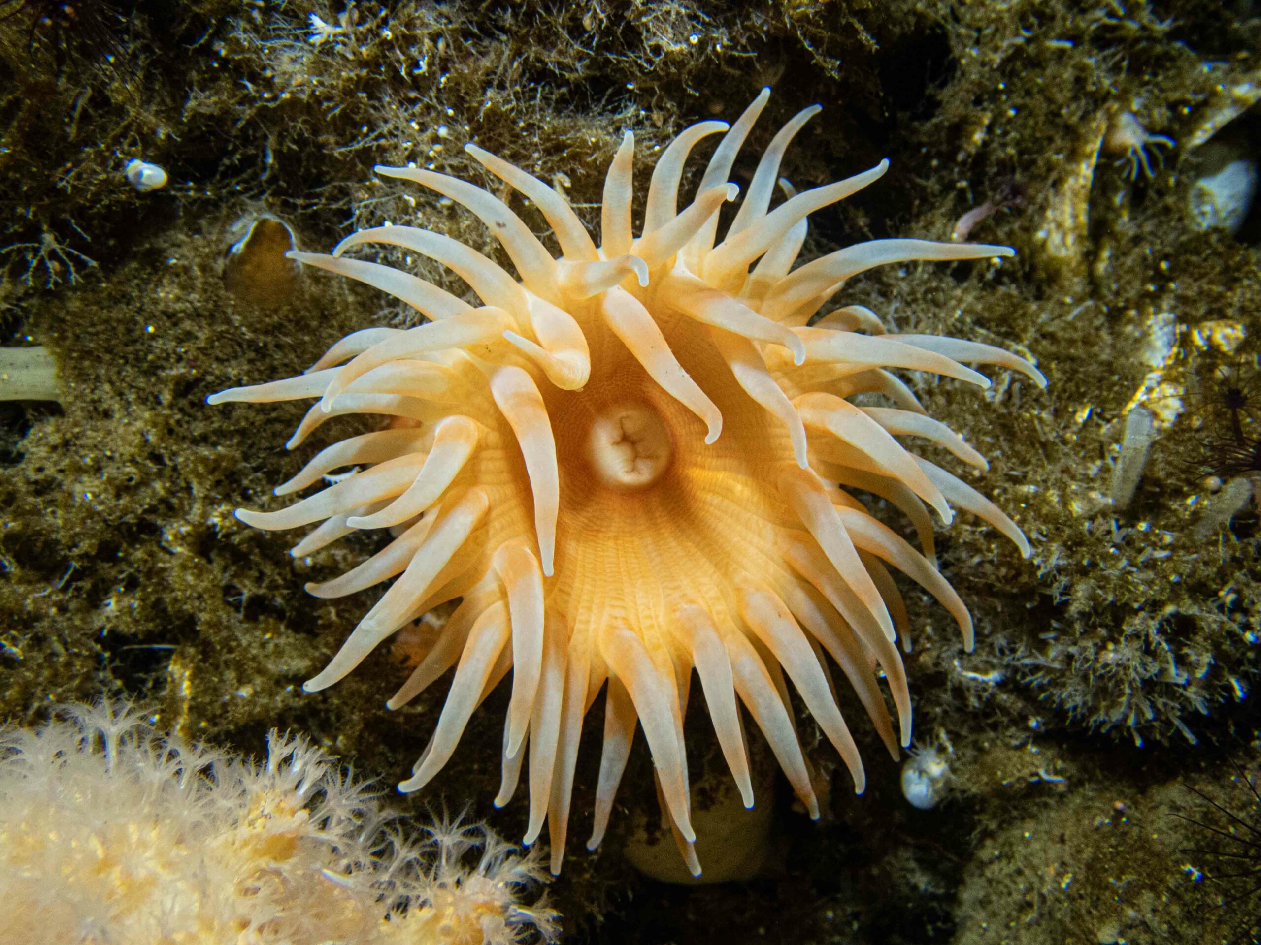
Most of the organisms living on the seafloor and in the water are invertebrates – animals without a backbone like the worms, anemones, and nudibranchs below. Most of them get food by filtering through the sediments and water for anything edible and expelling the rest. Whenever we dissect a sea star or urchin there’s a brown gut running through much of their bodies, filled with mud being processed for anything that might be of value.
Feather duster worm.Nudibranchs – can you find the one on the right? It’s cryptic, meaning it blends in to the hydroid it’s living on.A ctenophore (aka comb jelly). The rainbow rows are the fluttering iridescent ctenes (combs) they use to get around.A sea star in anchor ice.
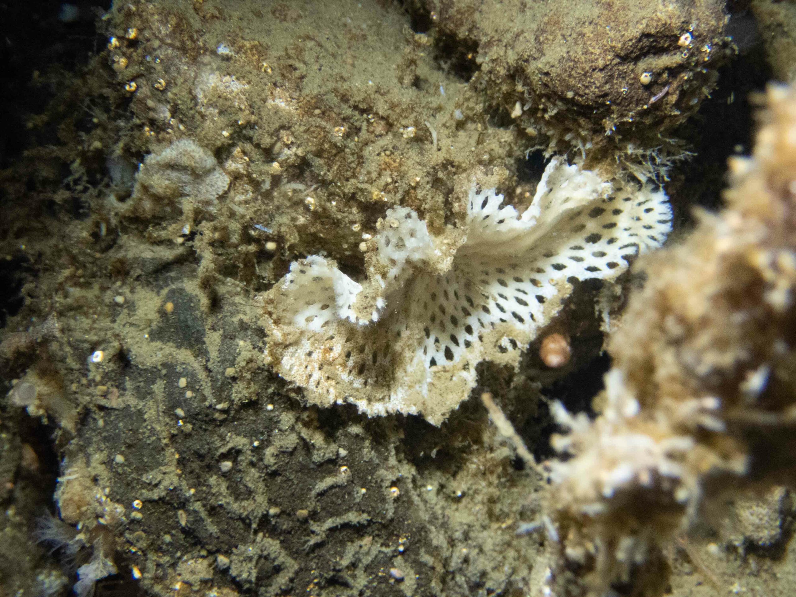
While picking out red sea stars to sample is easy, sometimes at first glance it’s hard to tell which spineless animal you’re looking at, even at a broad level. This bryozoan (a colonial invertebrate), for example, looks similar to some sponges, which are an entirely different group of animals. Rowan is sampling these for a potential project of hers – stayed tuned for more in a future post.
Other things are really apparent, like this neon spiky yellow sponge, although even these are hard to tell apart to species level with multiple species looking alike.
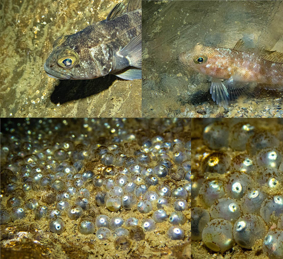
And yes, although invertebrates may be my personal favorite for all their complex and fascinating anatomy, so drastically different from our own, there are also fish. And down here, they too have fascinating adaptations. Many fish here, such as the Trematomus bernacchii below, have anti-freeze proteins in their blood allowing them to live in the almost -2 degree Celsius water that characterizes their environment.
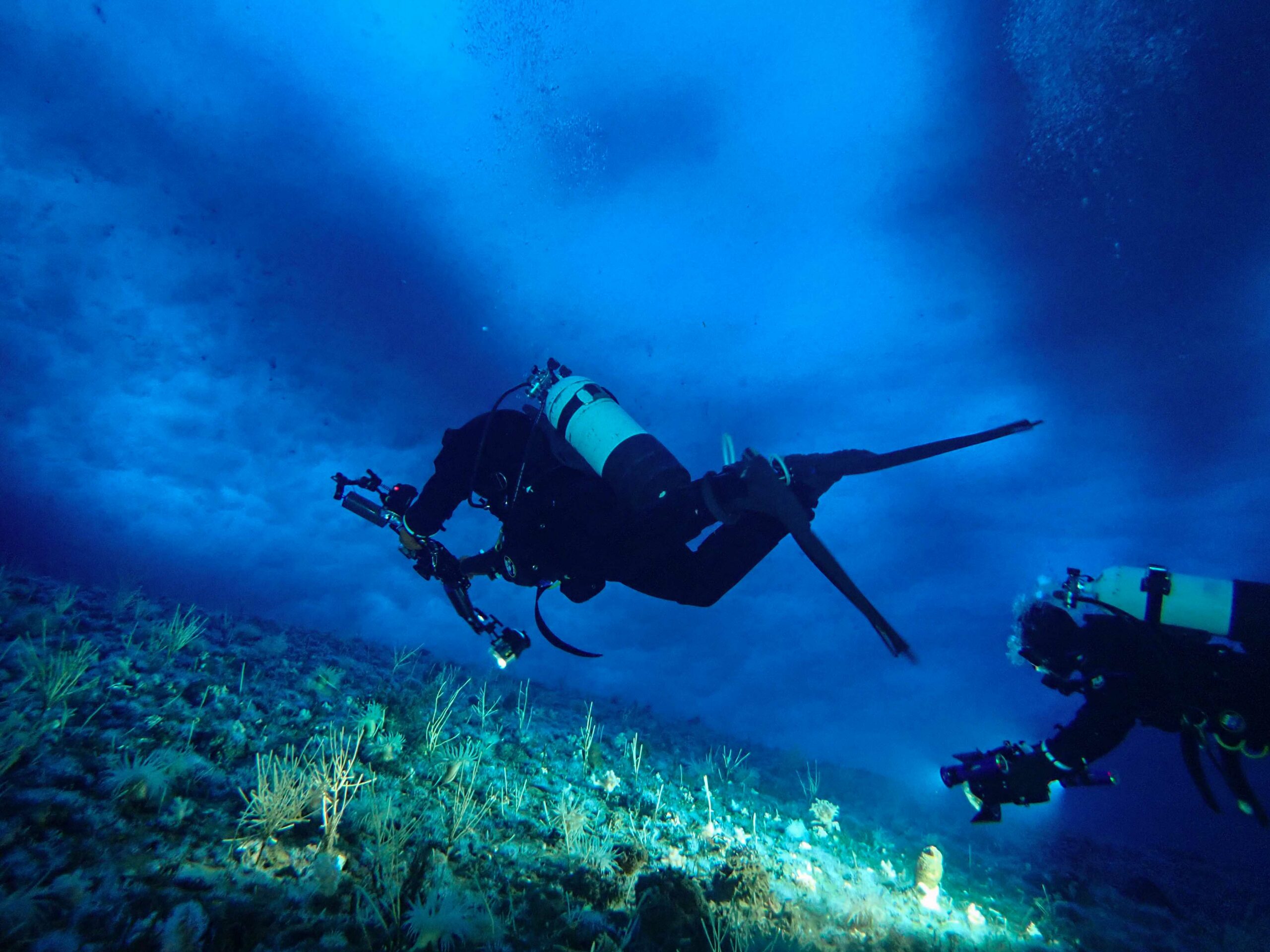
And then there’s us! Totally out of place, using 100+ pounds of gear and other technology to cheat our way into an environment for which our bodies are comically ill-adapted. Taking pictures in a place where we shouldn’t be able to breathe, adjust our buoyancy, or see well. I’m grateful to be here in this alien world, bringing photos back for you all to enjoy!
For the past week, we have been diving near the McMurdo Jetty. Our dive hole and hut are located very close to shores of Ross Island, and during our 15ft, 3 min safety stop – we enjoy playing underneath the sea ice close to shore in amongst the wonderous anchor ice.
This view of McMurdo Jetty and Observation Hill was taken from beside our dive hut (“hut 19”) on the sea ice. As you can see, our dive site is actually very close to shore. Photo credit: Rowan McLachlan
Achor ice forms in the spring/early summer here in Antarctica. Supercooled water flows out from underneath the ice shelves and moves North. Although this “supercooled” water is only 0.1-0.2°C [or 32°F] colder than the surrounding seawater (the annual mean water temperature in McMurdo Sound is -1.87°C or 28.6°F) the temperature difference is enough to stimulate ice crystal growth.
Diver Rob Robbins swims amongst the anchor ice at the Jetty dive site, McMurdo, Antarctica. Photo credits: Rowan McLachlan
Beautiful, shimmering crystals form in the water column and larger crystals start to grow on the seafloor. Eventually, a giant blanket of thick interlocking crystals known as “anchor ice” forms on the shallow seafloor, growing up to 2 feet thick in some areas.
A Sterechinus urchin moves across the anchor ice in McMurdo sound. It better be quick though, or else the anchor ice may grow over him! Photo credit: Rowan McLachlan
Swimming next to this anchor ice is a phenomenal experience. As you gently graze the anchor ice, the crystals break off and float up into the water column. With light reflected in all directions, you feel like you are inside a magical kaleidoscope or surrounded by fairy dust.
Anchor ice floating in the water column. Photo credit: Rowan McLachlan
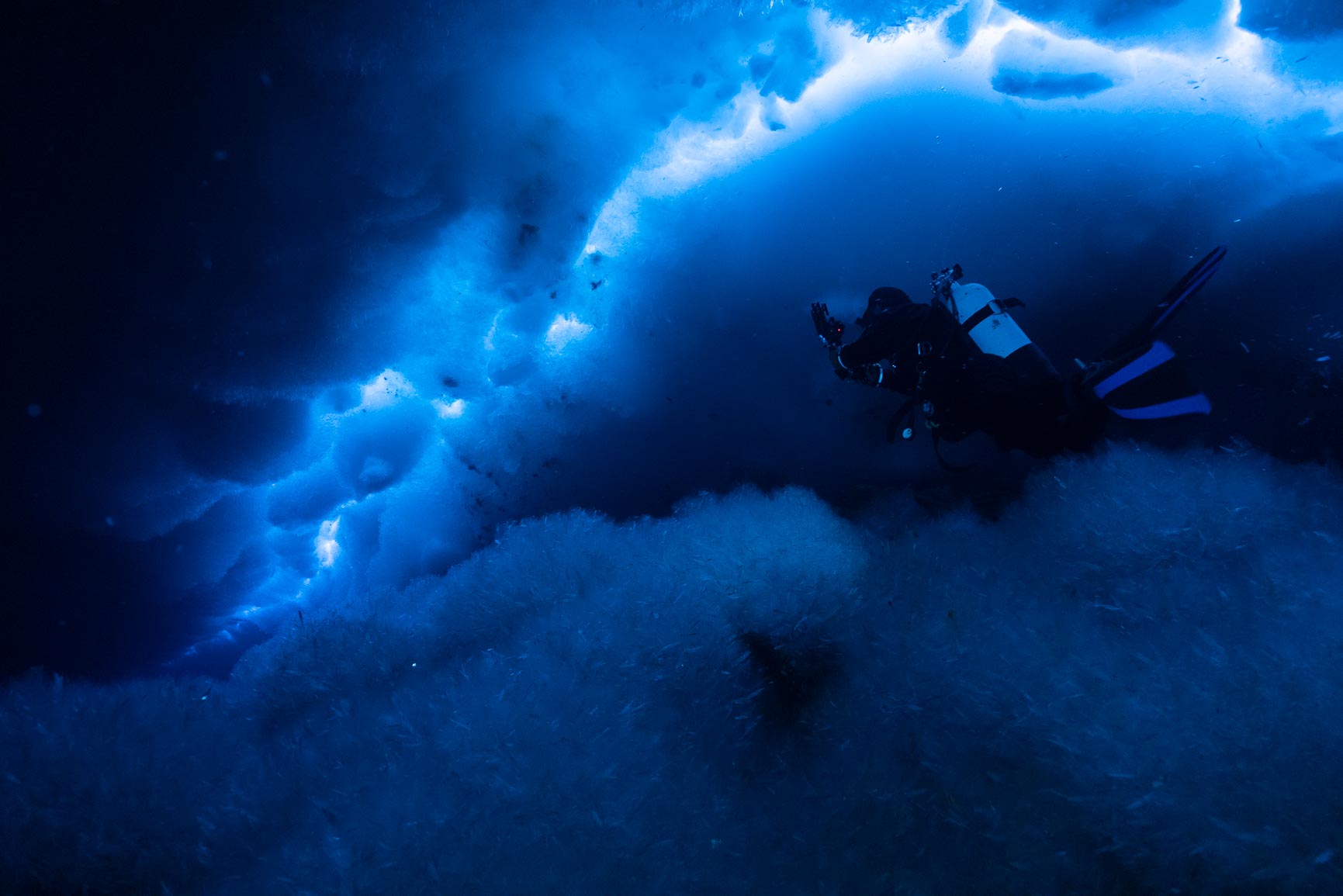
The experience of being beneath sea ice is almost indescribable. The colors of blue that pass through the cracks in the snow and ice are so beautiful – it almost reminds me of the milky way!
Today we took a bit of a break of stirring up the mud to collect samples to instead collect some images to better communicate what a remarkable environment we are privileged enough to dive in. Here is Rowan collecting some imagery up in the tidal cracks where we spend our “Safety Stops”. Safety stops are used to get the nitrogen that builds up in our blood while underwater out, and while we never spend long enough down to need to off-gas on the way up, it adds a safety margin to diving (and is pretty).
One of my favorite things about working under the ice here is that when we look up, it is a sky of ice above us rather than the surface of the ocean. At this (so far our main and only dive site) there is a lot of snow on top of the ice which makes it VERY dark underwater. We can see ok without lights (not great) but the cameras really struggle to collect good imagery. Above you can see a boulder covered by hundreds of Anemone as well as some soft corals with a crack in the background. This crack separates the shore from the ocean and is caused by the ocean tides rising and falling throughout the day, pushing the floating ice up while the ice stuck to the land stays where it is. The fuzzy bits on the rock in this image are plates of ice growing over everything (we are at around 40ft/13m depth here.
We actually spend more of our time underwater doing what Lila is doing here, sampling the mud. In this particular case, she is collecting water through a filter that is stuck in the mud. It only collects the water so we can analyze the chemistry to look at how th environment changes for microbial communities and animal communities with increasing depth.
I am always amazed at the blue’s of the water here in this land of ice both above and underwater. The ice stops at about 40-60ft but the coloration of the surface is spectacular.
Profiling Cracks to quantify how safe the sea ice is. That is Ross Island in the background on which McMurdo Station sits.
After almost 2 weeks, we have finally (I think) finished our 24 required trainings for fieldwork in Antarctica. Today was Chainsaw day but they have been as varied as waste sorting to helicopter riding in (although we don’t have any Helo time scheduled for this trip.) It is a good feeling since now we can get down to science.
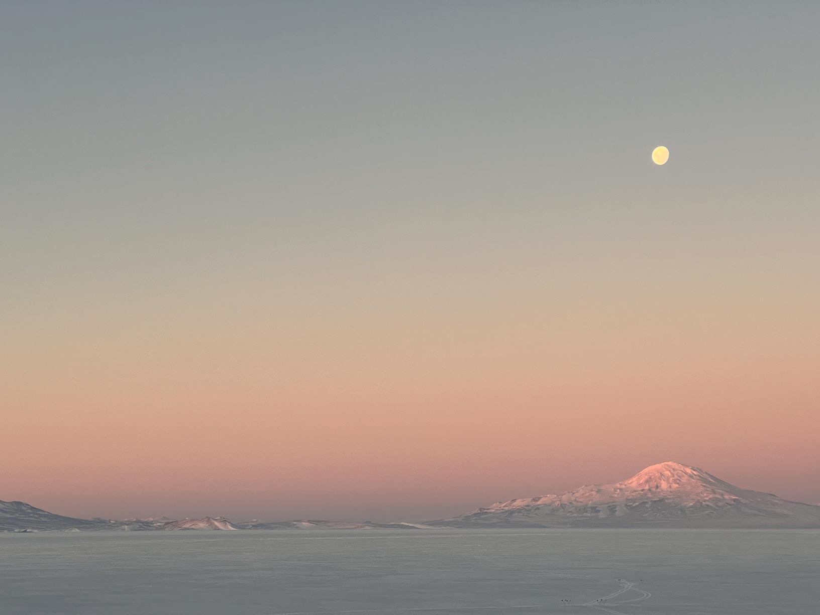
Moon over Mount Discovery. I never get tired of this view.
Today I am thinking of how grateful I am to be here. In this magical place. Under the freaking ice.
Of the officially recorded USAP divers (both McMurdo & Palmer Stations), 99 of the 400 – 500 (the number is somewhere in this range) have been women. On Wednesday, Rowan and I got to be 100 and 101.
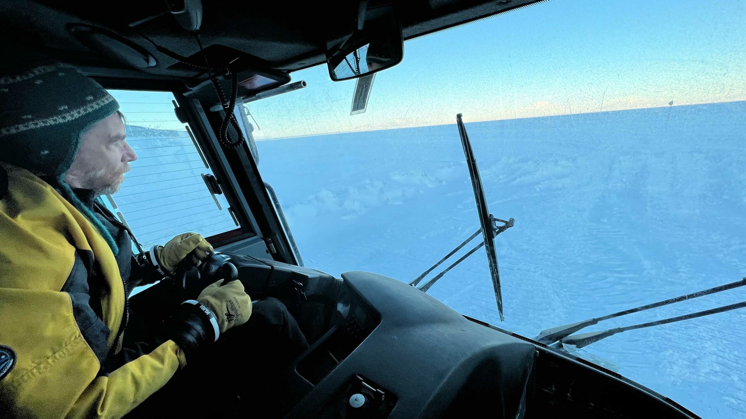
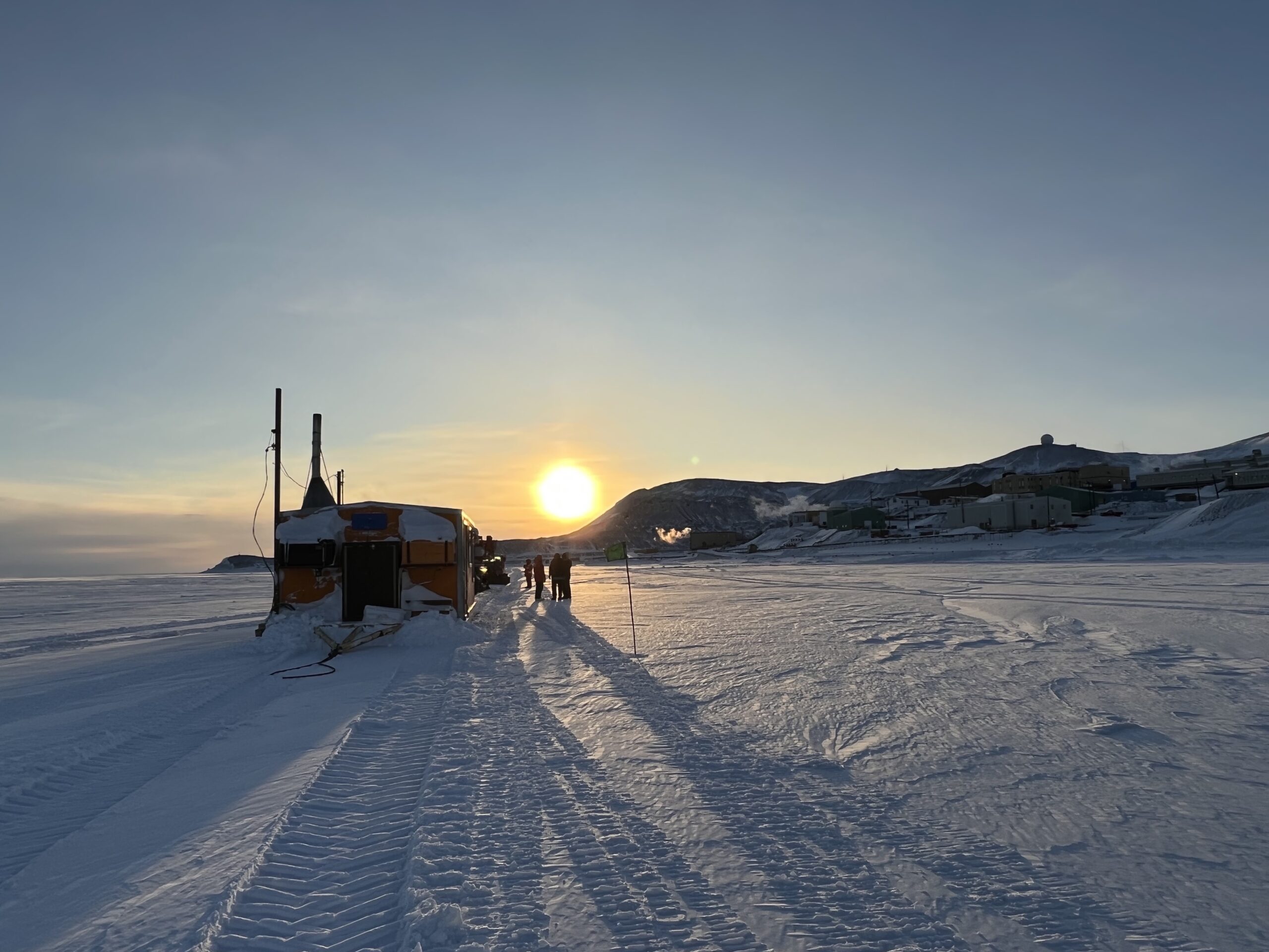
The next day, for my birthday, I got to do my first science dives collecting samples (the first two were warm ups, or…maybe cool downs? idk.). It was the best birthday present ever. On the ride out to the dive site (below), Rob and I talked about what a magical coincidence it is that we were born during this time. Diving first started in Antarctica in the 60s – people wore wet suits and let’s be clear that is way hardcore and must have been MISerable. So if we omit those years and think about how long in human history diving has been and will be possible, from the 80s until….an unknown, but potentially soon time in the next 100 years when there is no longer seasonal sea ice to dive through, that’s a shockingly small blip in time. A shockingly small window in which one would’ve had to be born to be able to do what I got to do on my birthday. In an effort to help others imagine this magical experience, here’s a description of that our first few days of diving have looked like. There is plenty more footage to come!
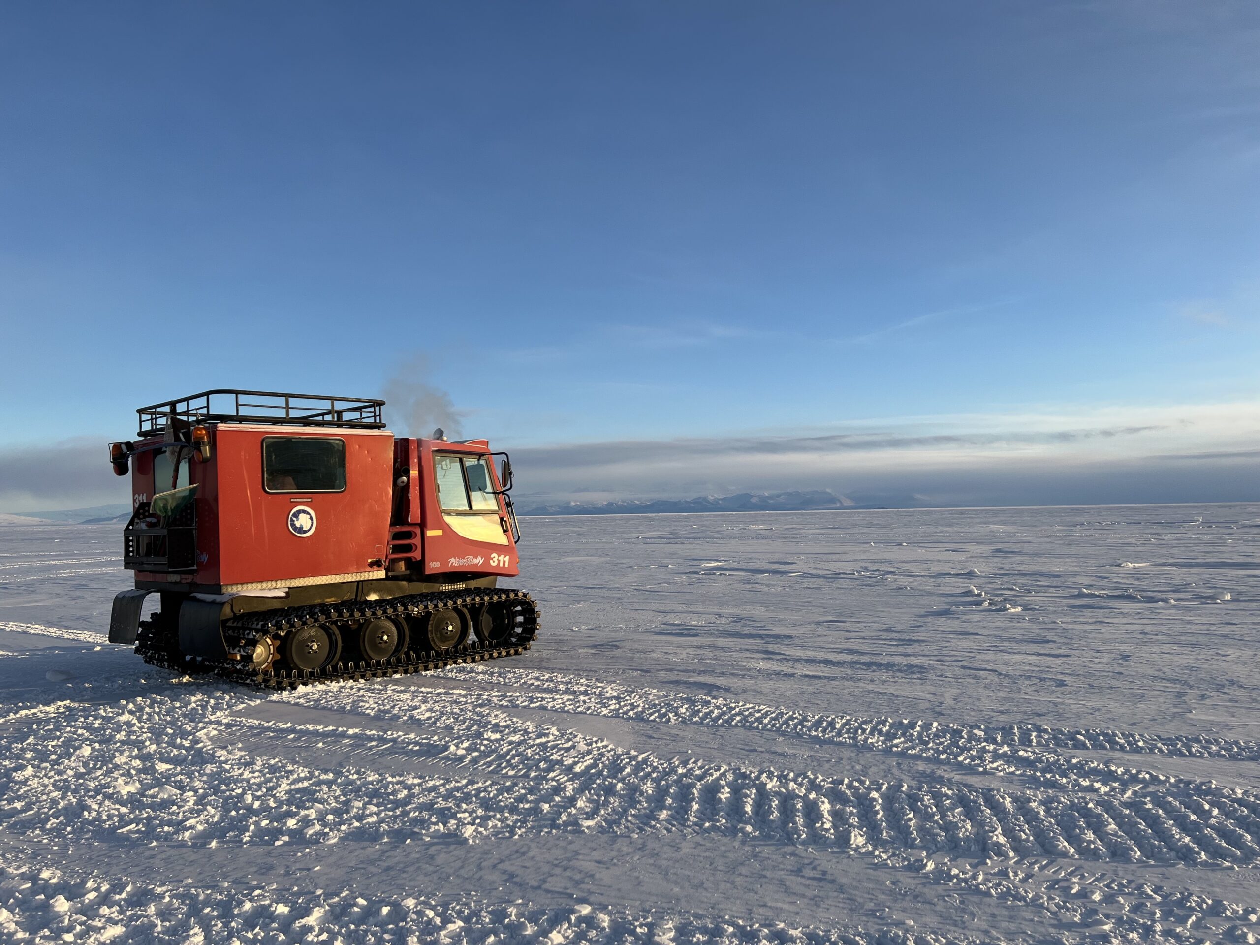
Rob driving the PistenBully out onto the ice.
First, after prepping our diving and science gear and getting all kitted up at the dive locker, we load up and drive out to the dive site in a tracked PistenBully vehicle (see Rowan’s last post if you’re curious). It’s a bumpy ride, but much better once you cross the transition from land to sea ice. These vehicles were made originally for grooming slopes, but on McMurdo serve the unique purpose of getting divers from town to their dive holes out on the sea ice.
Andrew loading gear into the hut. This particular bag contained cameras – yay imagery!
And we have the luxury of that dive hole being in a warm hut! Once we pull up to the hut, we unload all our gear into what has become a very steamy hut since opening the door to the cold world outside.
The plastic tube contraption hanging from the ceiling above our hole has a fan on top and does the very important job of blowing warm air into the dive hole and keeping it open. It’s no easy job getting the hole drilled and if left alone it would freeze back over very quickly. After removing the fan, we clip our dive gear onto loops at intervals along the descent line (which Andrew is holding above) and carefully drop it into the water. This is super helpful and allows us to get through the hole without clumsily clinging to a bunch of stuff or clipping it to our already bulky gear.
Once the gear is in, we all get the rest of our kit on alongside the dive hole. This process involves much whining and old man grunting and is only possible with the help of our lovely dive tenders – folks from the McMurdo community who take a break from their jobs to help us load up and prep for our dives.
And then, one by one, we all jump in, twisting around and aiming our tanks toward the middle of the hole. I’ll describe my first time through the magical portal into the under ice world. After chaotically (at least I felt chaotic) descending through a 2 meter (but seemingly eternal) tunnel filled with pieces of ice, you blink your eyes into a dark and cold expanse. Soon the down line, which has blinking lights along it so you can find your way back into the hole, becomes clear. It takes a while to gain spatial awareness and take it all in. I was so busy thinking about my kit and getting acquainted with my new dive watch that I didn’t even notice the blue crystal-covered wall in the distance. That wall is the edge of the jetty upon which McMurdo’s water intake system sits.
Our first dive, we dropped down to the bottom of our down line, which ends at about 72 ft under water. I couldn’t believe my eyes as I stared at the blue wall beyond, the glowing streaks of blue tidal cracks, and the bulbous crystal balls of ice shards along the underside of the ice. After exploring the sea floor and taking in for the first time all the fish, sea stars, urchins, and nemerteans (they’re worms that look like intestines) I had only ever seen in pictures, we moved toward the wall beyond. I tried to flip over and look at the ice ceiling above, forgetting at first that turning to the left would dump the air out of my arm. Right side up turns only! After getting that down I swam sideways, admiring the glowing links between the under ice world and the one I’d left above.
Me looking at the crystal shards of anchor ice along the McMurdo jetty. PC: Andrew.
The anchor ice along the jetty was fascinating. The closer I looked the more creatures I noticed hiding in its crevices. Every time my fin or hand brushed the ice, fragments would float up like icy confetti. I didn’t even notice the cold. Our safety stop flew by, that’s 3-5 minutes at 15 ft to prevent nitrogen in our blood stream from forming bubbles and problems.
Rowan swimming under one of the tidal cracks above us. PC: Andrew.
After spending our time admiring the shallows, we made our way back to the dive hole. Looking at the blinking lights in the distance I imagined it was close, but I was quickly reminded that Antarctic visibility (usually many hundreds of feet during this time) can be deceiving. After finally making it to the dive hole, one by one we each ascended back into the over world.
Under water you’re weightless – you forgot how much gear you’re wearing and the fact that it weighs more than 100 lbs. Once through the hole, your old friend gravity quickly welcomes back. You cling to the ladder for dear life, awkwardly attempting to unclip your gear so a tender can pry it free from your shoulders. Once you’ve hauled yourself up and gotten off your weight belt, you feel like a new human. A still very uncomfortable new human. It’s not until you manage to tear off your mask, and three layers of hoods that you feel like a real human again.
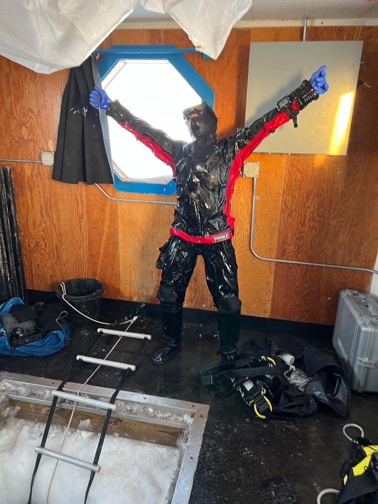
Me celebrating my first dive.The team post first dive!
After processing urgent samples along the side of the dive hole, its time to load back into the PistenBully and drive back to town.
You never look at the sea ice quite the same after your first dive. It’s a magical thing to know what lays beneath. It’s a sharp contrast to the sunny, white, glittering world we live in above.
Rowan in the back of the steamy PistenBully.
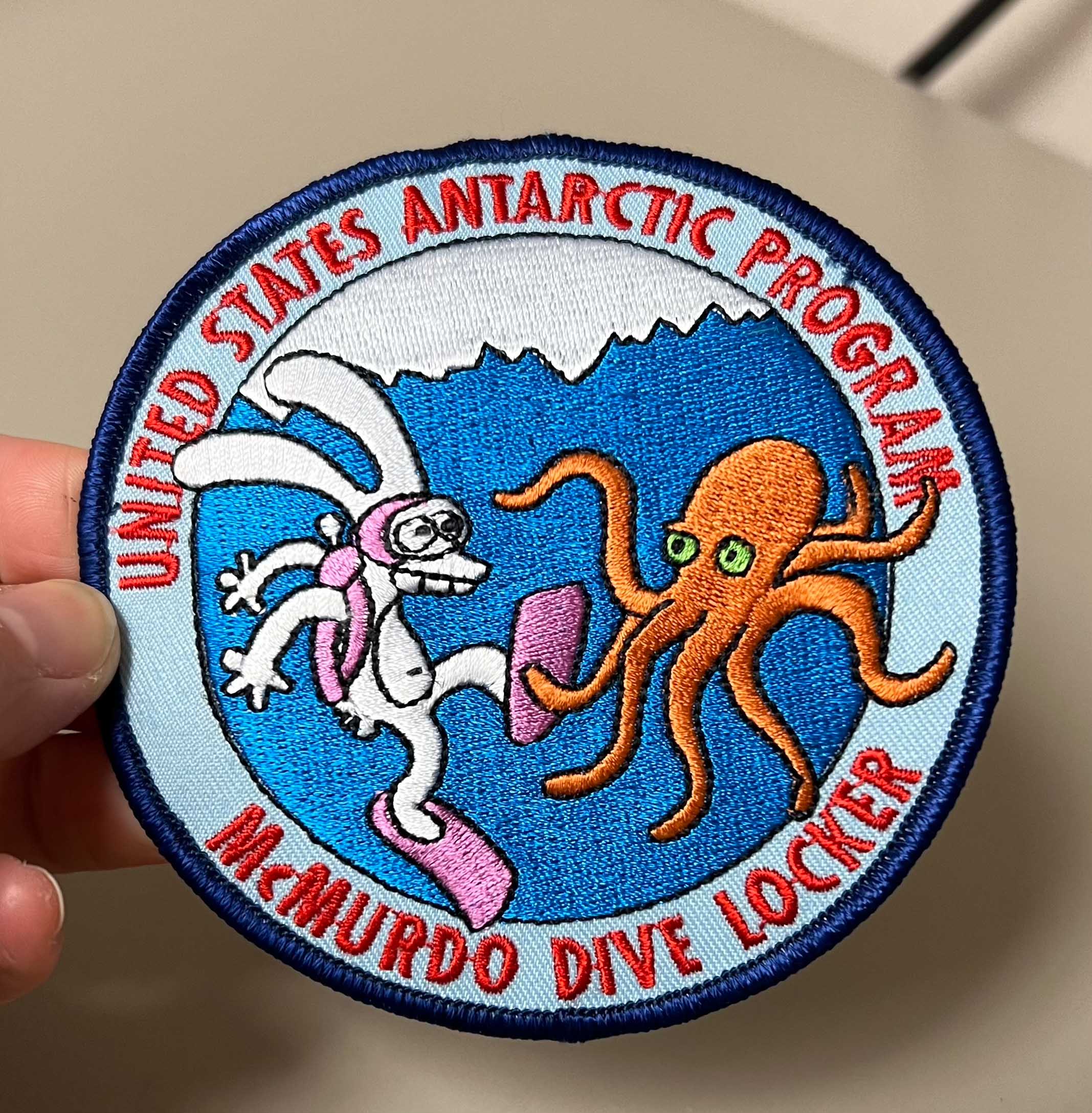
In honor of our first dive, Rob gifted Rowan and I each patches. As a collector of patches and stickers, I can easily say this is the one I will cherish the most. Not only will it always remind me of my rare privilege of diving under the Antarctic ice, of all the experiences in my life that brought me here to this magical moment, but it’ll also remind me of the extremely cool person who gave it to me. Rob has been diving here for the last 44 years and there’s no teacher I would rather have had under water with my on my first dive. My first dive, I was nervous – about the gear, about the conditions, about messing something silly up – but with Rob and the rest of my team there I knew I’d be okay no matter what and that’s a feeling I’m very grateful for. Every time since I’ve gotten more and more confident, and now after 5 dives I’m feeling just fine about each time I plunge through our magical ice tunnel, thanks to my awesome team.
Turns out, any direction when living in Antarctica!
This morning we took a short training course on how to use handheld GPS (Global Positioning System) units. When wandering around on this harsh continent, the last thing you want to do is end up lost with no idea of how to get back to somewhere warm!
To start out today’s training, we learned about the three different flavors of North: True, Magnetic, and Grid.
Grid North is a navigational term (used by pilots and boat captains) referring to the direction northward along the grid lines of a map. It is associated with map projection, in which the rounded shape of the Earth is projected into a 2D flat representation. Because we are so close to the pole, the map projection can be especially skewed here, so grid north isn’t particularly useful.
Magnetic North is not a fixed point on the Earth’s globe. Instead magnetic north is the direction that a compass points to as it aligns with the Earth’s magnetic field which actually shifts and changes over time in response to changes in Earth’s magnetic core. Here in Antarctica, we are too close to the magnetic south pole, and compasses don’t work here. The Earth’s magnetic field is not arranged in straight lines all the way from the North to the South pole. As you get closer to the Magnetic South Pole, the field lines will dive inwards, perpendicular to the Earth’s surface. Instead of pointing horizontally, your compass needle is actually trying to point straight down towards your feet!
True North (aka geodetic north, of geographic north) is the direction that points directly towards the geographic North Pole. This is a fixed point on the Earth’s globe. For this reason, True North is the best option for navigating down here.
The GPS models we are using down here are the Garmin GPSMAP® 78.
So how does it work? Well, satellites pulse signals down from space which are then received by the GPS unit. Because the Earth is spinning, and there is a delay between when the satellite sends the signal and when the GPS unit receives the signal – there is a margin of error in regards to how accurate your GPS is, and where it thinks you are located. The more satellites that reach the GPS unit, the more accurate it is at pinpointing your exact location. There are fewer satellites covering this part of the globe, understandably, but usually, we can get ~10-20 to connect.
In addition, there is no Wide Area Augmentation System (WAAS) available here either. The WAAS is an air navigation aid that enhances the accuracy of GPS. It uses supercomputers to correct errors. In the absence of WAAS, the accuracy of GPSs here in Antarctica is 9ft – which is not bad!
We use the GPS to mark where our dive sites are. At the moment, we only have one dive hole, located at the Jetty and very close to McMurdo Station. However, if we are able to reach some of the further away dive sites (sea ice thickness dependent), we will definitely rely more on the GPS, especially when the weather is bad and visibility is low!
Photo of dive hut 19. Inside, there is a hole cut in the ice through which we dive. This dive site is called “the jetty”. Photo credit: Rowan McLachlanPhoto of our PistenBully which we use to drive from McMurdo Station to our dive sites. Photo credit: Rowan McLachlan
Q: What is it called when someone smashes a compass? Breaking NEWS 😂
It was an amazing sunset looking north at the clouds and ocean and Royal Society Range in the background.
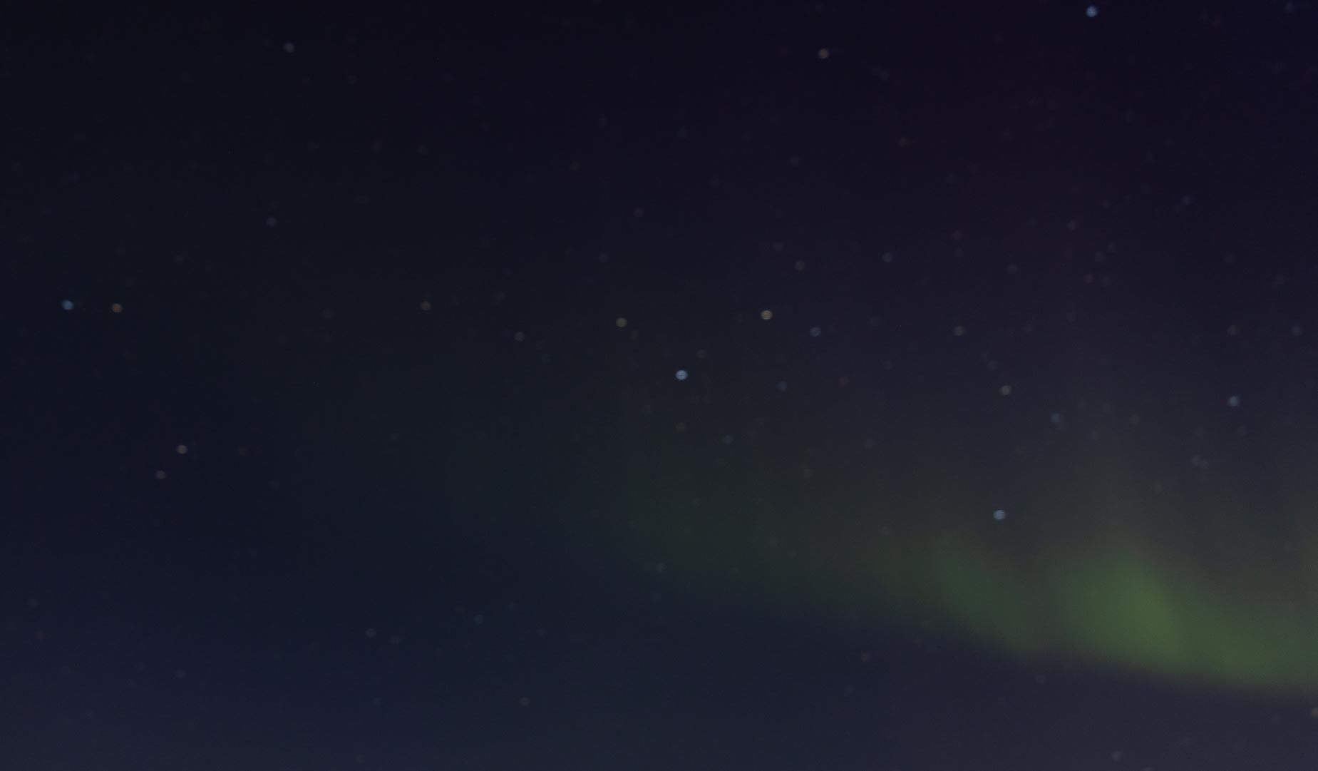
The southern lights, or Aurora australis, are the manifestation of solar storms hitting the earth’s magnetic poles and creating, sometimes, amazing color. There are many challenges in seeing them: 1) it has to be dark, 2) it has to be clear, 3) you have to be lucky to see them since they are incredibly ephemeral. One of the most challenging is the dark part. Usually, when most people are in Antarctica (which is already a pretty slim number of people) it is light 24 hours a day and so one just can’t see them. The other is that if it isn’t clear, no chance either. Sometimes most of the winter will go by when they are not visible because of clouds. And the sun rises then ending of the chance for 4-5 months until night sets in again.
Shooting in the pitch black, when the camera is soo cold that it burns to touch, and you are shooting constantly moving particles hitting the atmosphere is not the easiest photography. Plus, I find that just aurora images really need something in the foreground. This was a short (0.5 second) exposure and that meant it was pretty grainy (don’t like it).
Also, when they are faint they just look like clouds making it even more confusing. Plus.. it has to be dark… like really dark… like away from all lights. So not out the front window of your room. Often you see what might be them, run around the station getting cameras and lots and lots of warm clothing, and then go to the darkest spot you can find. Then find they were actually clouds or already stopped. I have only seen them two times in my years coming down to Antarctica. On Sunday, it was forecast to be nice and clear, and… there was supposed to be a solar storm! A perfect storm of weather and conditions to see the rare Aurora australis. We had talked about it all day and made plans to see them.
Here is another lackluster image showing the faint clouds that are actually aurora and an indication there is great photographic potential.
I had stayed up a little late doing a bit of work when I walked back to my dorm, I was pretty knackered only to look up and see Aurora! They were faint but I was in a well-lit area so that meant they were strong! I ran to my room to put on more layers and then to the lab to grab my camera and tripod before running (ok walking very slowly in so many layers) to a dark spot nearby. And started trying to take pictures. Taking pictures in the dark is hard. Little things like focusing… not easy. Exposures can either be relatively fast and grainy or slow and have stars move relative to the camera making them fuzzy or streaky. I have had issues getting images before. One time, it was so cold that my camera shutter simply froze open. The other by the time I got my camera, the aurora had turned off. On Sunday, I ended up with around 15 minutes of the Aurora showing where I was trying to get images and in the end only ended up with 1 that I liked:
This is two two minute exposures showing Observation hill in the background with it shrouded by the last of the aurora show.
This one was two images combined with different focus settings to try and see what I saw. I was happy that at least the camera didn’t call it quits halfway through but the Aurora shut off.
I wanted another chance though so I woke up at 4:45 am to see if I could see any more, only to find overcast skies. If we are lucky, we might see them again before the sun gets all the way up or maybe next year.
The other atmospheric oddity this time of year is Nacreous Clouds. We also had those today (as in Lila’s post) and here is another image of them and the wonderful sunset that was a prelude to the Aurora joys.
Nacreous clouds are pretty things and you can see some just above the statue on the hill, to the upper right.
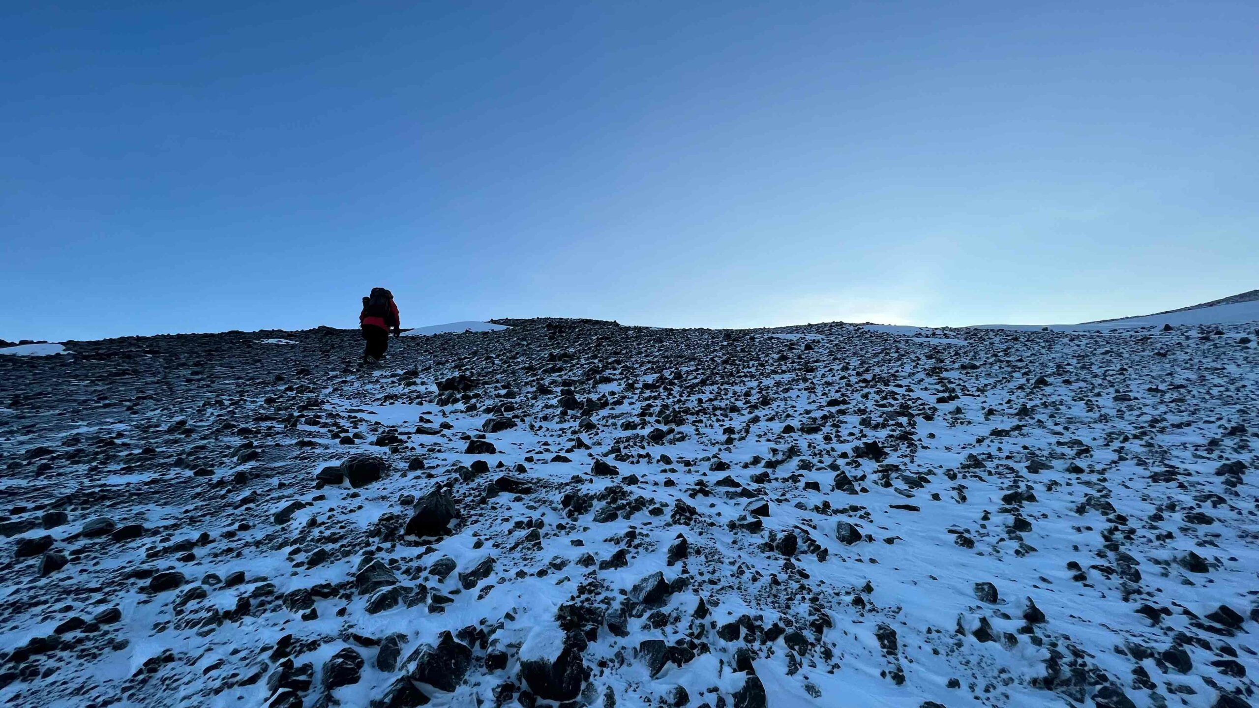
I must admit, before yesterday, no matter how many times I looked at a map, I remained pretty confused about exactly which direction I was facing or where I was in relation to…well anything other than McMurdo. Not only is the position of McMurdo a bit confusing – it faces water, but that water is McMurdo Sound and not ocean to the North – we landed in the pitch black on an aircraft with basically no windows. Luckily for me, it all makes sense after getting to look at my new home from higher ground. For most folks on station, Sunday is the universal day off and we took this opportunity to hike up onto the icy plateau of the Hut Point Peninsula. That’s the peninsula of Ross Island, the tip of which is home to McMurdo and Scott bases (see map further down).
We set off right after brunch (another awesome Sunday occurrence in McMurdo), wearing our Sunday best (aka every layer we own). Plus extras, so called “ECW plus plus.” As we get acquainted with our own best layering systems, we always play it safe. It would stink to be hours from station and wishing you’d brought that fleece.
We made our way up to the trailhead (McMurdo is on a hill), and over the next hill to the plateau. This was arguably the hardest part of the hike and we definitely paused to ditch a layer or two before even leaving sight of station. It was fun to pass by Ivan the Terra Bus, which carried us from the airstrip just one long week ago.
Still slogging uphill from station, with Transantarctic Mountains in the background.
Just when your fingers or face start to get a bit uncomfortably cold, and you’re really wishing there were some place out of the wind to readjust your system, a cute little red shelter (aptly called an Apple or a Tomato) comes into view. It’s tall enough that the average person can stand up in it, and provides a barrier from the wind with some basic emergency gear inside, but is unheated and wouldn’t be the most fun place spend a night if weather conditions rapidly turned. It’s always important to check the weather before leaving station!
Inside the warming hut we readjusted layers, drank water, and got chilly. Turns out you get cold again when you stop moving – more of a cooling hut actually.
After warming back up, we continued upward, finally making it onto the plateau, with Castle Rock jutting out in the distance. After spending all week in town, it was a welcome change to get to stand in the glacial expanse of the peninsula, with no manmade structures other than our trail flags in sight.
Three flags mark a junction between two safe trails.
These flags play the important role of telling us where it is safe to walk. Glacial regions like this can have hidden crevasses, cracks which can be 10s or 100s of feet deep and covered with snow, invisible to the oblivious hiker. Thankfully, McMurdo has a Search & Rescue team, usually made up of experienced mountaineers, paramedics, and/or guides with SAR experience, that navigate and flag these routes for the community.
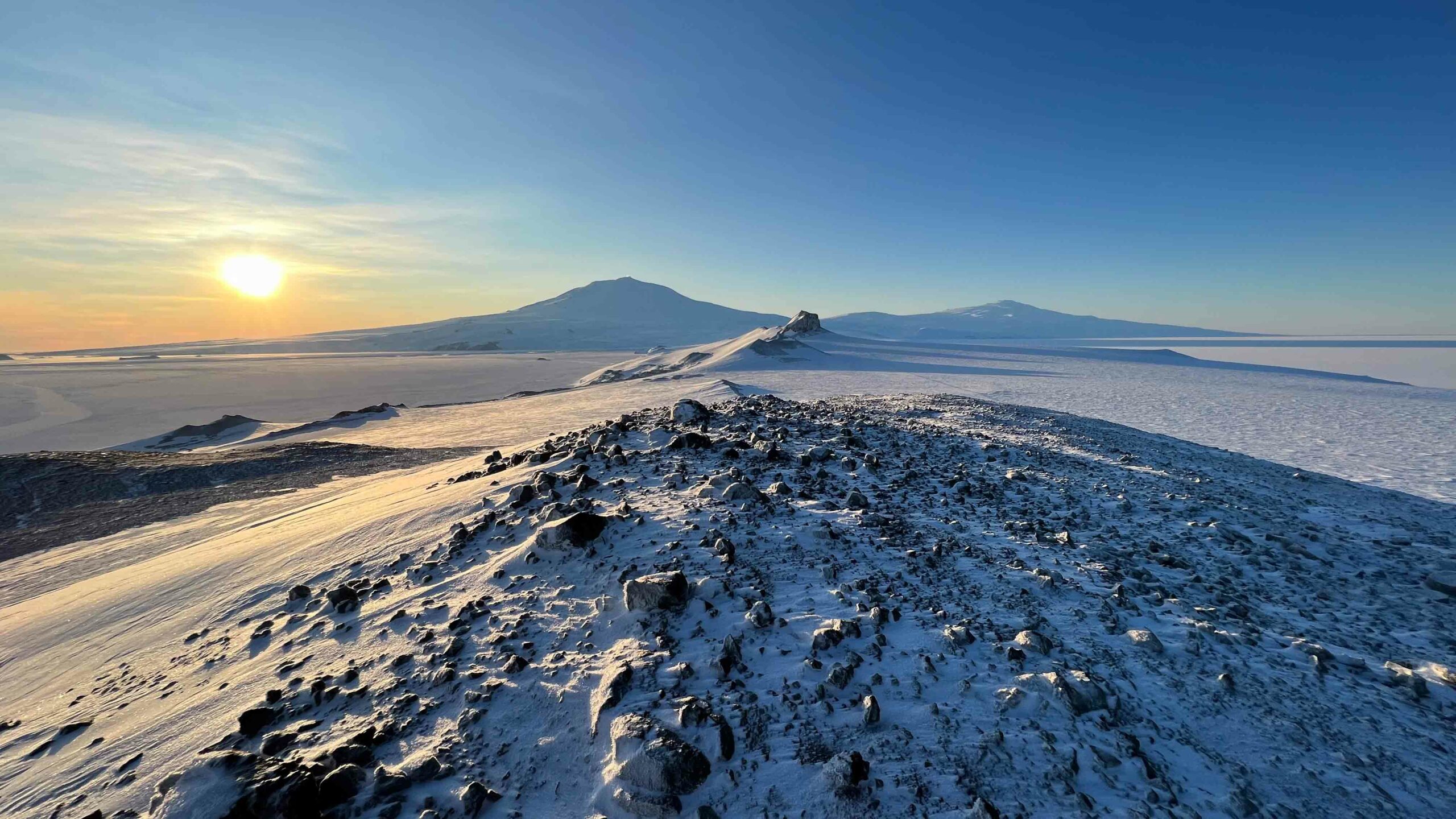
This particular turn-off led us up a rocky ridge (no crevasses to worry about here, phew), which led us to an absolutely stunning panoramic view of the peninsula and the volcanoes which make up most of the remaining island. It’s from here that I finally managed to grasp where I was.
Here I’m facing roughly NW, the Transantarctic Mountain range stretching northward into the distance, and the small dark Dellbridge Islands near the center of the image.
Above, looking roughly NE and straight down the peninsula, one can see castle rock and beyond that Mt. Erebus to the left and Mt. Terror to the right. These two shield volcanoes are names after the HMS Erebus and HMS Terror, the two vessels aboard which British Royal Navy officer James Clark Ross and his team discovered the Ross Sea, explored its uncharted Antarctic coastlines, and came across Ross Island in 1841. Mt. Erebus is the southernmost active volcano in the world, and some of the teams passing through McMurdo Station conduct research from field camps located on the volcano itself.
In front of Erebus and Terror, one can make out the edges of Ross Island and the slopes of the Hut Peninsula, descending into seasonal sea ice (relatively thin sea ice, <1 m – several m thick) on the left and permanent ice shelf (floating glacier, 100s m thick) on the right.
Here I am looking roughly to the SE, the Ross Ice shelf extending for hundreds of miles into the distance (it’s about the size of France). I can’t imagine what it must have been like for early explorers to make it even to Ross Island by way of the Southern Ocean, nor can I imagine standing here and looking to the South, knowing the nearly 1000 miles (1600 km) of travel by foot (carrying heavy sledges) that it would take to get there.
In this image, one can also make out the Willy Air Field where our C17 landed last week. I feel incredibly fortunate to be alive in an age where we get to make it here that way instead.
After an enlightening and windy detour, we headed further toward castle rock, sun illuminating its angular, snow-covered, glittering walls in the distance. Later in the hear one can actually ascend the rock itself, via a roped path, but that’s closed off for now.
Castle Rock, with Mt. Erebus in the background and a teeny tiny apple/tomato to its right for scale.
Let me tell you. All this ECW gear keeps you relatively warm when you get your layering down just right, but it is not lightweight. Rowan and I did take a quick moment to collapse on the way back. And I did try to make a snow angel, but the ice packed snow did not oblige.
The ice snow was really pretty to look at though! So many glitter, much ripples.
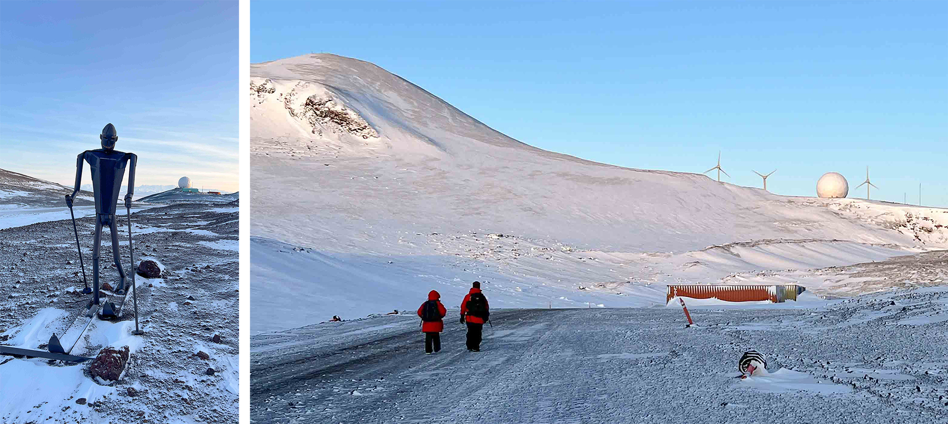
Left: A metal sculpture of a skier. Right: Three wind turbines, installed by the joint efforts of USAP and Antarctica NZ, which produce enough energy (under ideal conditions) to power 100 average American households and save an estimated 240,000 gallons of diesel fuel per year.
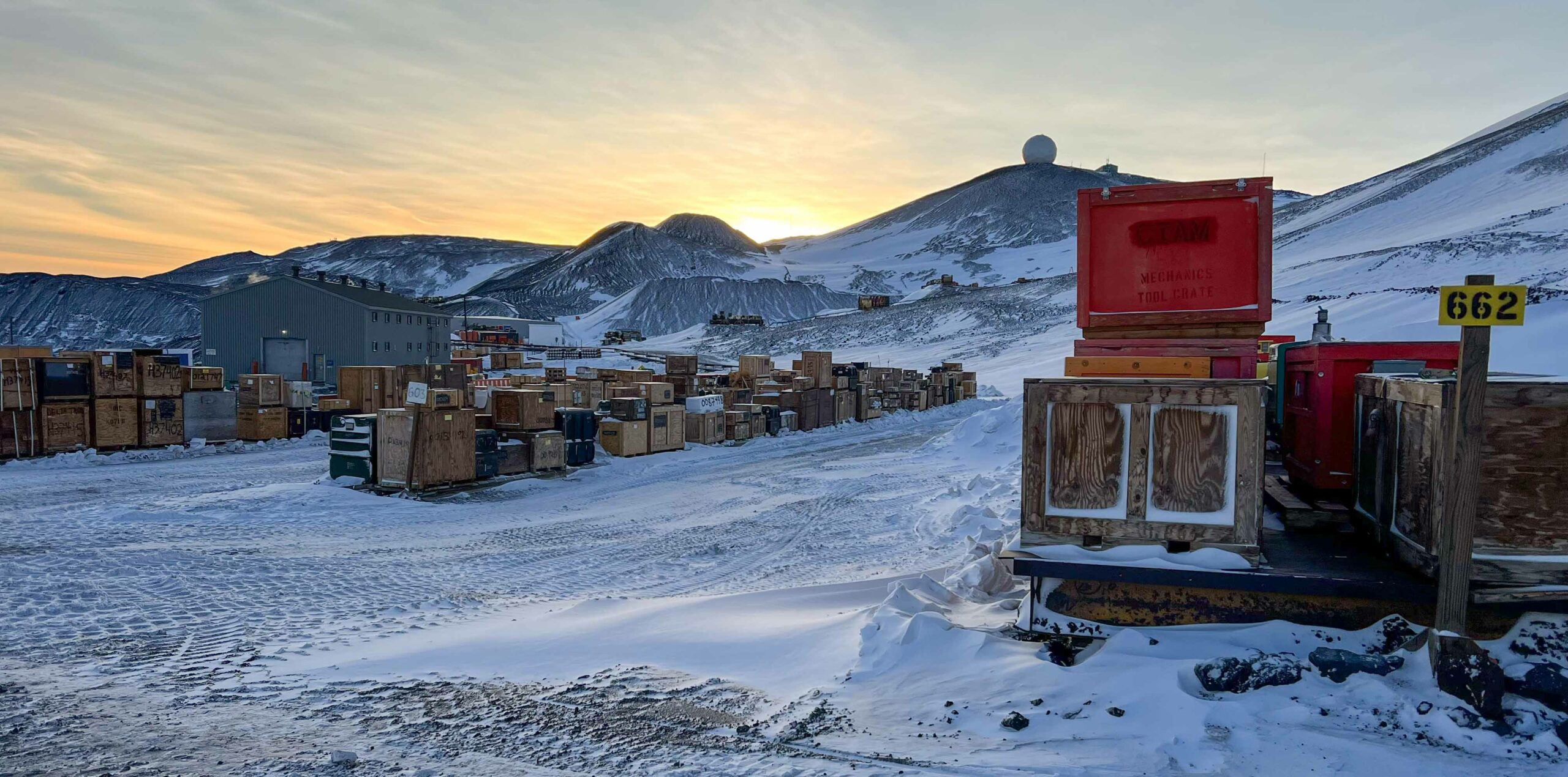
As we descended back into McMurdo I was ready for the warmth of the buildings, the quirky character of the town, and the comforting rows of storage containers filled with all the things one needs to be comfortable and do science in what could otherwise be a very unfriendly place.
I have no idea.
After a half-day adventure and a big dinner to refuel, we got to end our evening with a beautiful nacreous cloud sunset, as seen from behind our dorm. The most obvious nacreous clouds in this image are those in the top right, but much of this sunset had the dancing rainbow colors that I’ve only ever seen here. It’s hard to believe it won’t be long before the sun comes up to stay.
“Whether the weather be fine, Or whether the weather be not, Whether the weather be cold Or whether the weather be hot, We’ll weather the weather Whatever the weather, Whether we like it or not.”
The United States Antarctic Program’s (USAP) McMurdo Station is located on the southern tip of Ross Island, Antarctica. The station is positioned 850 miles north of the South Pole and 2,415 miles south of Christchurch New Zealand.
The mean annual temperature at McMurdo is -18°C (0°F). In the summer months (October-February) temperatures can rise to a cozy 8°C (46°F). However, now (September) we are currently at the end of Winter.
The temperatures during winter can drop to -50°C (-58°F). While the air temperature is often in the tolerable range, the wind chill decreases the temperature substantially and can make it unbearable for any exposed skin. The average wind is 12 knots (2.3 mph), but winds have exceeded 100 knots (115 mph) in the past.
Here is a snapshot of today’s weather forecast. Sunbathing anyone?
Earlier this week, the visibility looking across the McMurdo Sound was substantially reduced due to heavy winds carrying snow. A view that normally looks like this…
View of Mount Discovery across McMurdo Sound. Photo credit: Rowan McLachlan
… quickly turned into this:
View of dive shed with whiteout background. Photo credit: Rowan McLachlan
To track how the snow storm, I set up the GoPro on a tripod looking out of our lab window in the Crary Laboratory Building and started a timelapse. I started recording at 3:30 pm on Thursday and stopped recording at 09:30 am on Friday (so 14 hours total). I then sped up the video to condense it into a 30-second clip.
At the start of the timelapse, you can glimpse MacTown citizens scuttling around at the end of their work day. Then the snow starts to gather on the window as the sun sets. During the night, through the gaps between the snow, watch for the waxing crescent moon glide across the sky. Finally, in the morning, the storm has passed and we are welcomed with the glorious sight of Mount Discovery in the distance and the warm rosy pink sky.
While the gathering of snow drifts and heavy winds shown here may seem extreme, this was actually just a mild day at McMurdo. In fact, when I asked whether it was categorized as a storm or a blizzard, I was laughed at. Thanks Andrew!
The weather conditions here at McMurdo are split into three categories, and each category has restrictions regarding if and when we can go outside. Here are the descriptions of the three weather categories and their corresponding travel restriction, as defined by USAP:
Condition 3 – Considered the normal weather condition in McMurdo. Check out with the Firehouse or Central Communications is not required for vehicular travel during summer months, but is required during winter months. Recreational travel is only permitted during Condition 3 weather.
Condition 2 – You must check out with Central Communications by radio prior to leaving McMurdo and check in upon your return.
Condition 1 – All travel by vehicle or foot requires prior approval from the NSF station manager.
Under condition 1 conditions, everyone must stay in the building where they are at the time of the announcement. If you are out in the field, you need to set up your tent from your survival kit. As you cannot go outside, people just have to hunker down and stay put until the storm has passed. Depending on where you are, you may end up stuck in your office building overnight, or if you are lucky, be stuck in the galley! For this reason, it is important to always have food (and a book) stashed in multiple places around town, just in case. Normally, the weather office is able to give people a 2-3 hour warning ahead of time, but not always. The weather in Antarctica is highly unpredictable, and can change at any moment!
Acclimating to the weather here is an important process, I am discovering. As a tropical coral biologist, I usually pack sunglasses and swimsuits when I go on field expeditions for my research. Now, anytime I want to go outside it is a 5 min ordeal of getting kitted up! Once, I made the mistake of thinking I could just run between buildings in just my base-layer clothing. Let me tell ya: that was a mistake! #regrets
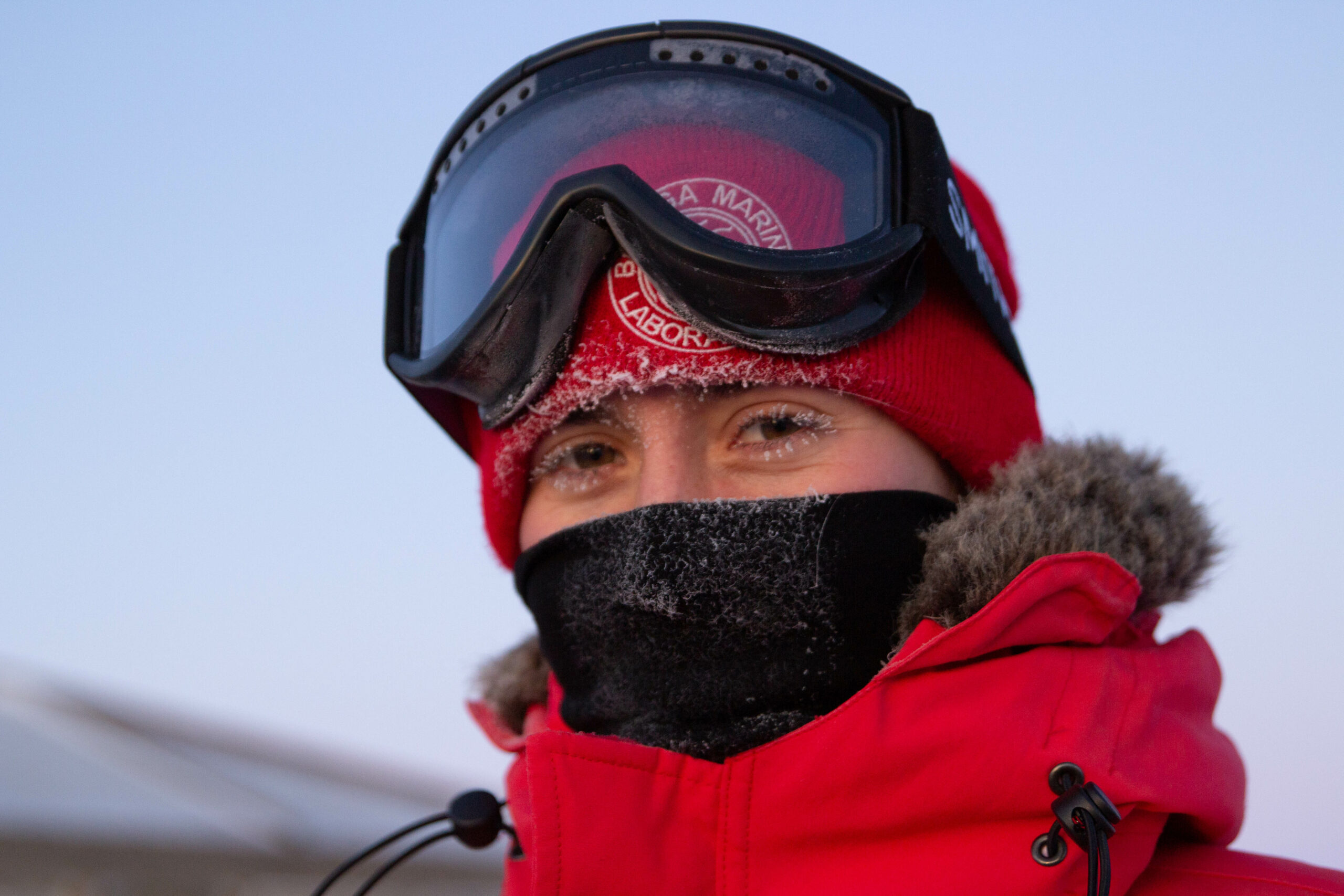
If even a tiny part of your skin is exposed to the elements for a minute, all the moisture soon starts to freeze! Here’s Lila after our short walk last night:
View from Crary Lab window. Photo credit: Rowan McLachlan.
We’ve landed. We’ve settled in. And now we are ready to do science, right? WRONG!
Before we are even allowed to leave the station for a casual stroll, we must complete a long list of important training courses that will ensure we are always safe and heathy on this amazing, but harsh continent.
Training course topics include:
Antarctic field safety
Cold illness and injury awareness
Light vehicle training
Tracked vehicle training
Helo (helicopter) safety
General waste and recycling management
Laboratory and chemical waste management
Fire safety, Medical
IT security
Outdoor recreation safety lecture
Sea ice safety, GPS training
MacOps communication briefing
Harassment awareness and prevention
Heater use and troubleshooting
Chainsaw safety (for cutting ice).
Today we started with the Antarctica Field Safety (AFS) course taught by the Field Support & Training (FS&T) center. [P.S. There are a LOT of acronyms used here at McMurdo!]
The purpose of this course is to provide the necessary survival training should anyone find themselves in an emergency situation while working in Antarctica.
Antarctica is one of the most beautiful and pristine places on Earth, but it also presents one of the harshest environments. In particular, the extreme cold, wind and sea ice are potential hazards that can be limb- or life-threatening. Therefore, everyone must be informed and ready to act should something untoward happen. For example, if we were working off-base, far from McMurdo Station and suddenly the weather changed for the worse, we would need to buckle down where we are and ride out the storm.
The first things we discussed in the course were all relating to Risk Management and how to identify, prevent and minimize potential risks associated with working in Antarctica. At first we brainstormed as a group to create a list of objective and subjective risks, including, but not limited to:
extreme cold weather
reduced visibility
extremely strong winds
high UV exposure (reduced ozone here)
dehydration
fatigue
crevasses
cracks in sea ice
communication issues (broken radios etc)
We then discussed how to create a 6-step decision making model risk management tool. Again, lots of acronyms used in this part of the course including S.M.A.R.T. goals (Specific, Measurable, Achievable, Relevant, and Time-Bound) and P.A.C.E. planning (Primary, Alternate, Contingency, and Emergency).
Next we learned about survival bags. Every time a group leaves McMurdo base to work in the field, they must take with them a Survival bag. This bag contains everything needed to keep two people alive for three days in an emergency.
AFS Training Course. Photo Credit: Lila Ardor Bellucci
Contents of the survival bag:
Sleeping bag
Sleeping pads
WhisperLite stove + fuel
Snow shovel
Food rations
Pot and utensils
First aid kit
Tent
Cord
Spare clothing
Ice screws
Ice saw
Photo showing the contents of the survival bag. Photo credit: Lila Ardo Bellucci
After looking through the contents, we learned how to use these tools conventionally, as well as creatively. For instance, an ice saw is conventionally used to cut blocks of ice when building igloos and wall, but creatively, this long metal tool can also be used as a splint to set a fracture or sprain. Likewise, the bag itself is used to carry all the supplies, but as this is made from waterproof material, it can also be used as a windbreaker or a mini-tent for anyone entering into mild hypothermia.
Next, it was time to learn how to use the WhisperLite camping stove.
Rowan McLachlan successfully lit the stove without burning the building down. Photo credit: Lila Ardor Bellucci
This stove can use a variety of different fuel types including white gas, kerosene, and unleaded gasoline. And it is so compact!
Contents of stove bag. Photo credit: Lila Ardor Bellucci
After this, we learned how to pitch BlackDiamond Fitzoy 3-person tents.
Andrew Thurber: Scientist, Photographer, and Professional Tent-Pitcher. Photo credit: Rowan McLachlan
Although this model is a little trickier to put up compared to most other tents, its pole design and tight pitch mean that this is one of the sturdiest tents out there and suitable for weathering the harsh Antarctica storms in an emergency situation.
Okay, so the tent is up, but what do you tie the guy lines to to prevent it from blowing away in the gale? There are no trees or rocks on the sea ice… The answer: dig V-thread holes in the ice using ice screws!
Lila Ardor Bellucci making sure the instructor doesn’t screw up. Photo credit: Rowan McLachlan
You then put the guy line down one side of the v-shaped hole, and use the ice screw to catch it on the other side and pull it up. Next, use a T-hitch and secure your tent to the ice!
The last component of the Antarctic Field Safety course was Cold Illness and Injury. I have to say – although this was arguably the most important component of today’s training – I enjoyed it the least. #Squeamish. This presentation contained lots of visually disturbing images of frost-bitten fingers and toes, and something known as “degloving”. I dare you to google degloving if you are unfamiliar.
Some of the cold injuries we covered were:
frost nip
frostbite
hypothermia
chilblains
Raynauds syndrome
cold water immersion
Here are some of the less-gory slides from the presentation:
source of above slides: FS&T at McMurdo
The take-home messages from this part of the training were:
Your body is an engine and needs water and food as fuel. To stay warm you must eat and drink!
Layered clothing is key to reducing heat loss in Antarctica. Start with a moisture-wicking base layer, then use fleece layers, and finally, a wind-proof outer layer is required for staying warm
The buddy system is vital for identifying if someone is suffering from cold-induced illness or injury. If someone’s behavior changes (e.g. if a normally loud person starts to become quiet, or a normally quiet person starts to be loud and incoherent), they themselves may not be aware – so look out for one another! Likewise, if the tip of someone’s nose turns white, it is up to their buddy to let them know as they themselves may not be able to feel it!
Today’s training was 4 hours long. However, this was actually the condensed version of this course. The full-length version used to be called “Happy Camper” training, but unfortunately, they don’t teach it anymore. In the Happy Camper training, you apparently went out onto the ice, pitched your tent, cut and built an ice wall, and then spent the night sleeping on the ice in the shelter you made! We are all a bit disappointed that they don’t do this anymore as it sounded really fun! Regardless, we learned a lot in today’s course about how to survive in an emergency – and hopefully, we never need to apply any of it!